Sacramento County approves 9,356-home Upper Westside plan west of North Natomas
The Sacramento County Board of Supervisors on Tuesday approved the Upper Westside Specific Plan, establishing a framework for more than 9,300 homes, commercial development, schools, parks, and public infrastructure on largely agricultural land west of North Natomas.
The decision followed more than four hours of presentations, public testimony, and board deliberations. Seventy-six people were signed up to speak, with supporters describing the project as a response to the region’s housing shortage and opponents raising concerns about traffic, farmland conversion, habitat, flooding, and the cost of public services.
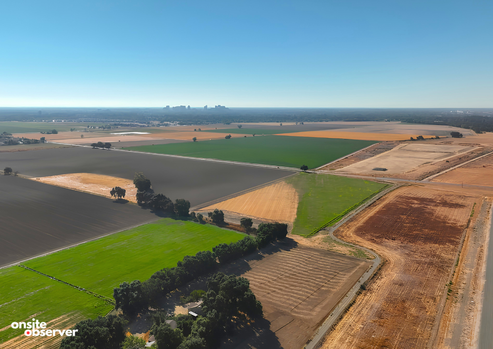
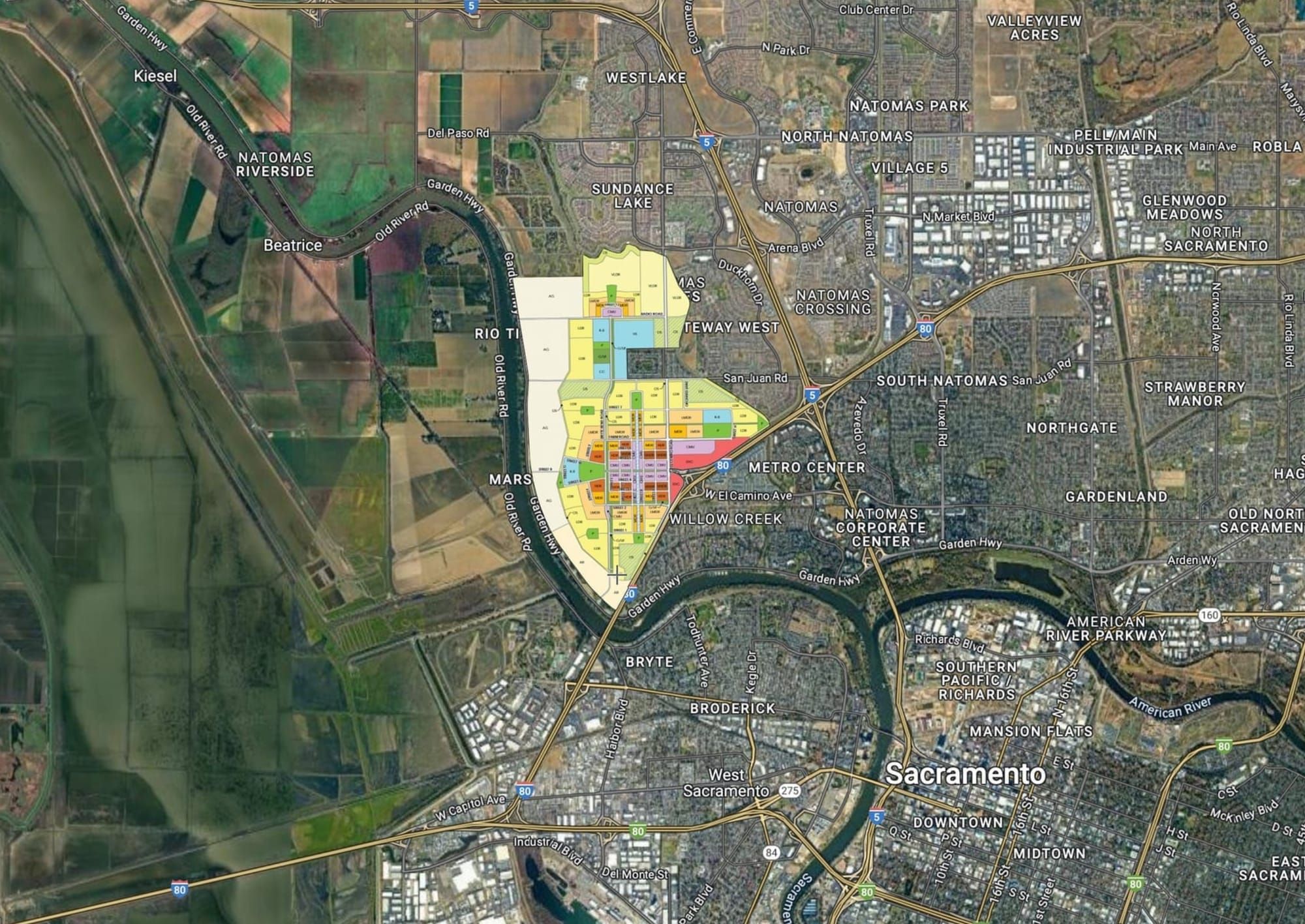
Upper Westside encompasses approximately 2,066 acres between Interstate 80, Garden Highway, Fisherman’s Lake Slough, and the West Drainage Canal, about 3.5 miles from downtown Sacramento. The approval places a 1,524-acre development area inside the county’s Urban Policy Area and Urban Services Boundary, while a 542-acre agricultural buffer along the western edge would remain outside those boundaries.
“This is the right project at the right time when solutions are needed to address our region’s critical housing shortage,” said Nick Avdis, an attorney representing Upper Westside LLC and the participating landowners.
The plan allows 9,356 homes across a range of densities. The allocation includes 2,149 low-density homes, 1,079 low-medium-density homes, 743 medium-density homes, 910 high-density homes, 791 very-high-density homes, and 168 very-low-density homes. Another 300 units are reserved for “missing middle” housing, while as many as 3,216 homes could be built within commercial mixed-use areas.
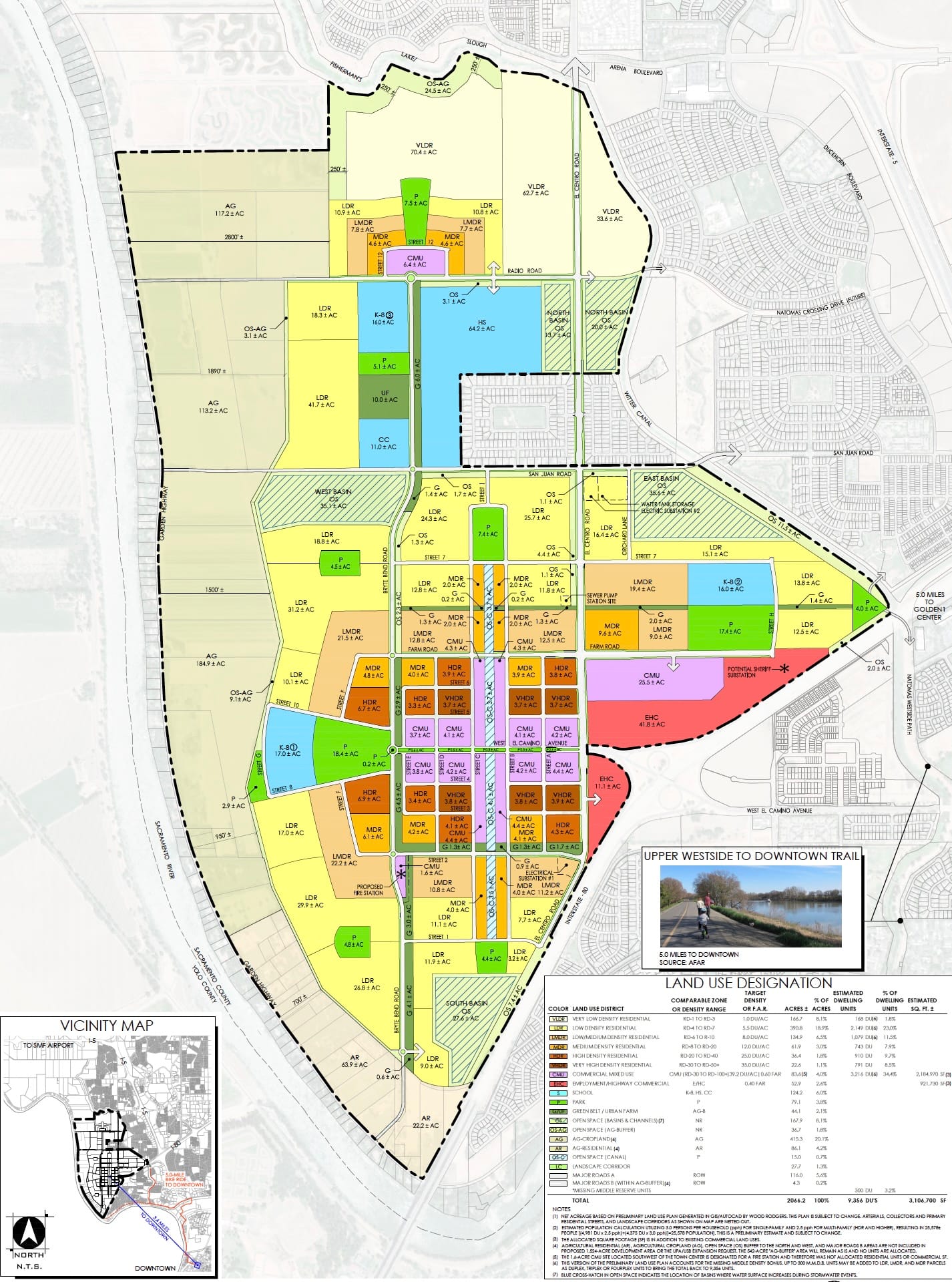
At buildout, Upper Westside would also include 83.6 acres of commercial mixed-use development, 52.9 acres of employment and highway-commercial uses, 124.2 acres for schools, and approximately 327.7 acres of parks and open space. The applicant estimates the plan could support about 3.5 million square feet of commercial development and more than 8,000 permanent jobs.
The community’s centerpiece would be a higher-density town center built around the Westside Canal, a proposed one-mile waterway that would also function as part of the project’s stormwater system. Plans call for an approximately 80-foot-wide water surface, bicycle and pedestrian promenades along both sides, and three public boat-launch areas for kayaks, paddleboards, and small electric boats.
Approximately 4,500 homes would be concentrated in and around the town center, according to the applicant’s presentation. The district would also include mixed-use buildings, shops, restaurants, offices, and a median park along West El Camino Avenue that could accommodate farmers' markets, festivals, and other events.
The overall plan includes 10 public parks totaling approximately 76.5 acres of active recreation space. More than 90% of the planned homes would be within a quarter-mile walk of a park. The transportation network includes approximately 14 miles of separated Class I bicycle and pedestrian trails and more than 36 miles of buffered Class II bicycle lanes.
About 90% of homes would be within a half-mile of a proposed transit stop, with 15-minute service planned during the morning and evening peak periods.
Supervisor Phil Serna, whose district includes the project, described the property as “this large infill opportunity on a different scale,” pointing to its proximity to downtown, North Natomas, the Sacramento Railyards, Metro Air Park, and the region’s freeway system.
“I also believe firmly that this plan has not been rushed,” Serna said. “As a Natomas resident for almost a quarter century, I see this as an opportunity that, quite frankly, probably should have been considered years ago.”
Serna’s motion included several changes intended to address concerns raised during the review process.
The board selected an alternative circulation plan that would prevent Radio Road from becoming a regular vehicle connection to Garden Highway. The connection would instead be retained for emergency access, with traffic-calming measures required on surrounding roads.
County analysis found that eliminating the connection could reduce projected traffic on Garden Highway by approximately 2,900 vehicles per day. About 2,000 of those trips would shift to El Centro Road, resulting in a net reduction of roughly 800 daily trips across the five primary routes serving the plan area.
The change would improve projected traffic conditions on Garden Highway and Power Line Road, but El Centro Road between Arena Boulevard and Radio Road is expected to deteriorate from level of service E to F.
The approval also requires a roadway safety audit and traffic-management measures before roadway connections to Garden Highway are constructed. The project would make a fair-share contribution toward paved shoulders between San Juan Road and Power Line Road and would fund required turn lanes at project intersections.
Video of the Upper Westside plan area, captured in June 2025
A $500,000 public art endowment was also added to the development agreement. The project is separately obligated to pay $1,000 per home into the county’s infill fee program, with supervisors discussing whether that money could eventually be directed toward completing the town center.
Supervisor Pat Hume said the county must pursue traditional infill development while also approving carefully planned new communities capable of producing different types of housing.
“We have neighborhoods in Sacramento County that have traditionally been affordable for young families, for blue-collar workers, for people who are just struggling to get by, and they’re being priced out of their neighborhoods because there’s not enough new product coming online,” Hume said.
Hume said that if the canal and town center are constructed as presented, the district could become “one of the most desirable micro neighborhoods in Sacramento County.”
Board Chair Rosario Rodriguez said the housing would serve several income levels, expand opportunities for homeownership, and broaden the county’s property and sales tax base.
“I think this is the kind of project that really will be a game changer for the Sacramento region,” Rodriguez said.
The project’s planning-level financing program identifies approximately $907.4 million in backbone infrastructure and public facility costs. Development is expected to occur over about 20 years, beginning with a proposed 295-acre first phase, although the sequence could change in response to the housing market and infrastructure availability.
A county fiscal analysis projected that Upper Westside would generate an annual General Fund surplus of approximately $8.9 million at buildout. It also projected a $2.3 million annual deficit for road maintenance, which would be covered through a community facilities district paid for by property owners within the development.
The county’s affordable housing calculation gives the full plan an obligation valued at approximately $75.4 million. That requirement could be met through the construction of 852 affordable homes, the dedication of 42.6 acres of land, or another county-approved combination.
The participating landowners in the first phase have proposed dedicating 4.96 acres to the Sacramento Housing and Redevelopment Agency. Within the town center, developers would be required to build 302 affordable homes or dedicate approximately 9.15 acres for affordable housing.
The plan reserves land for three K-8 schools and one high school. Natomas Unified School District already owns a roughly 64-acre high school property south of Radio Road. Los Rios Community College District has also expressed interest in an approximately 11-acre vocational campus that could focus on agricultural or technology programs.
The school district has not reached a financing agreement with the applicant, however, and warned that statutory developer fees and possible state funding may not cover the future cost of building campuses.
“While we appreciate the progress made in working with county staff, we continue to have significant concerns about the escalating costs of building schools due to the uncertainty surrounding construction costs and the project’s development timeline,” district representative Heather Brown told supervisors.
Brown said state construction money and other financing sources “are neither guaranteed nor sufficient to fully fund the facilities needed to serve future students.”
Water was another central issue during the meeting. Upper Westside is expected to require approximately 4,000 acre-feet of water annually at buildout. The city of Sacramento previously determined that it has enough wholesale surface water to serve the development, but the city has opposed the broader project.
The county consequently approved an alternative that could use raw water supplied by Natomas Central Mutual Water Company and treated at a new facility within Upper Westside. The Sacramento County Water Agency is expected to operate the retail water system under either arrangement.
Opponents argued that the county should not urbanize the property while concerns remain about habitat, regional planning, and the capacity of nearby roads.
“This is a huge rezone of farmland to development,” former Sacramento Mayor Heather Fargo said. She pointed to opposition from the city of Sacramento, Sutter County, the Environmental Council of Sacramento, and the Natomas Basin Conservancy.
“You should not take that opposition lightly,” Fargo said.
Kevin McCray, a longtime Garden Highway resident and former Natomas Basin Conservancy board member, urged the county to consider stronger transit connections before expanding the urban boundary.
“I don’t think you’ve fully explained yourself how you’re going to account for all the traffic connecting onto the freeway,” he said.
The environmental impact report identified significant and unavoidable effects involving farmland conversion, air quality, noise, transportation, population growth, tribal cultural resources, and changes to the existing rural landscape. Supervisors adopted findings that the project’s housing, economic, environmental, and land-use benefits outweighed the remaining impacts.
Approval of the specific plan does not allow construction to begin immediately. Individual developers will still need rezones, subdivision maps, design reviews, infrastructure plans, and permits from county, state, and federal agencies, including wildlife approvals for impacts involving the giant garter snake and Swainson’s hawk.
County Planning Director Todd Smith told supervisors that development of a specific plan of this size would take multiple decades and require years of additional technical and regulatory work before the first homes could be built.
Upper Westside project location
Author

Vitaliy Moskalenko is a development reporter passionate about documenting how communities grow. Through Onsite Observer, he delivers site visits, drone footage, and research-driven stories that bring transparency and context to local development.