The Capital SouthEast Connector: A partial revival of Sacramento’s forgotten beltway.

In the decades following World War II, Sacramento's future appeared destined to unfold along an ambitious web of highways. City planners and state engineers envisioned a comprehensive network of beltways, bypasses, and expressways designed to accommodate the capital's postwar growth and transform it into a well-connected modern metropolis.
By the early 1990s, however, many of these grand plans had been scrapped, defunded, or erased from state maps. Freeway proposals such as State Routes 143, 148, 244, and 102 faded into obscurity, leaving behind only fragments—short highway stubs, outdated interchanges, and phantom rights-of-way.
Today, one project stands as a partial revival of that forgotten vision: the Capital SouthEast Connector.
In the late 1950s and early 1960s, planners envisioned a full outer loop around Sacramento, mirroring the beltways of other major American cities. This loop was intended to relieve downtown congestion and guide suburban expansion.
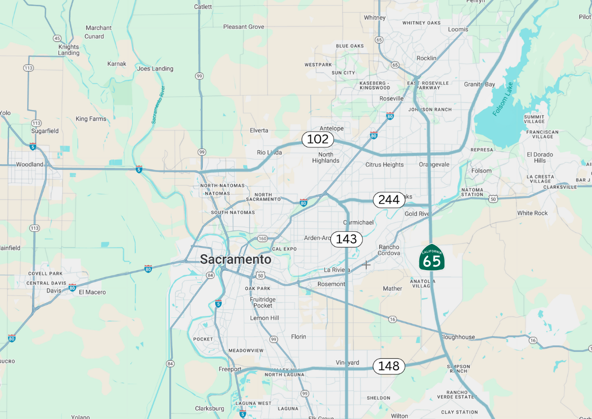
Among the proposed routes: State Route 65 would run north-south along the eastern edge, connecting Roseville to Bakersfield; Route 148 would arc east of the city from Elk Grove to Folsom; Route 102 would stretch northeast toward Auburn; and Route 143 would connect Franklin Boulevard to Highway 50 near Rancho Cordova.
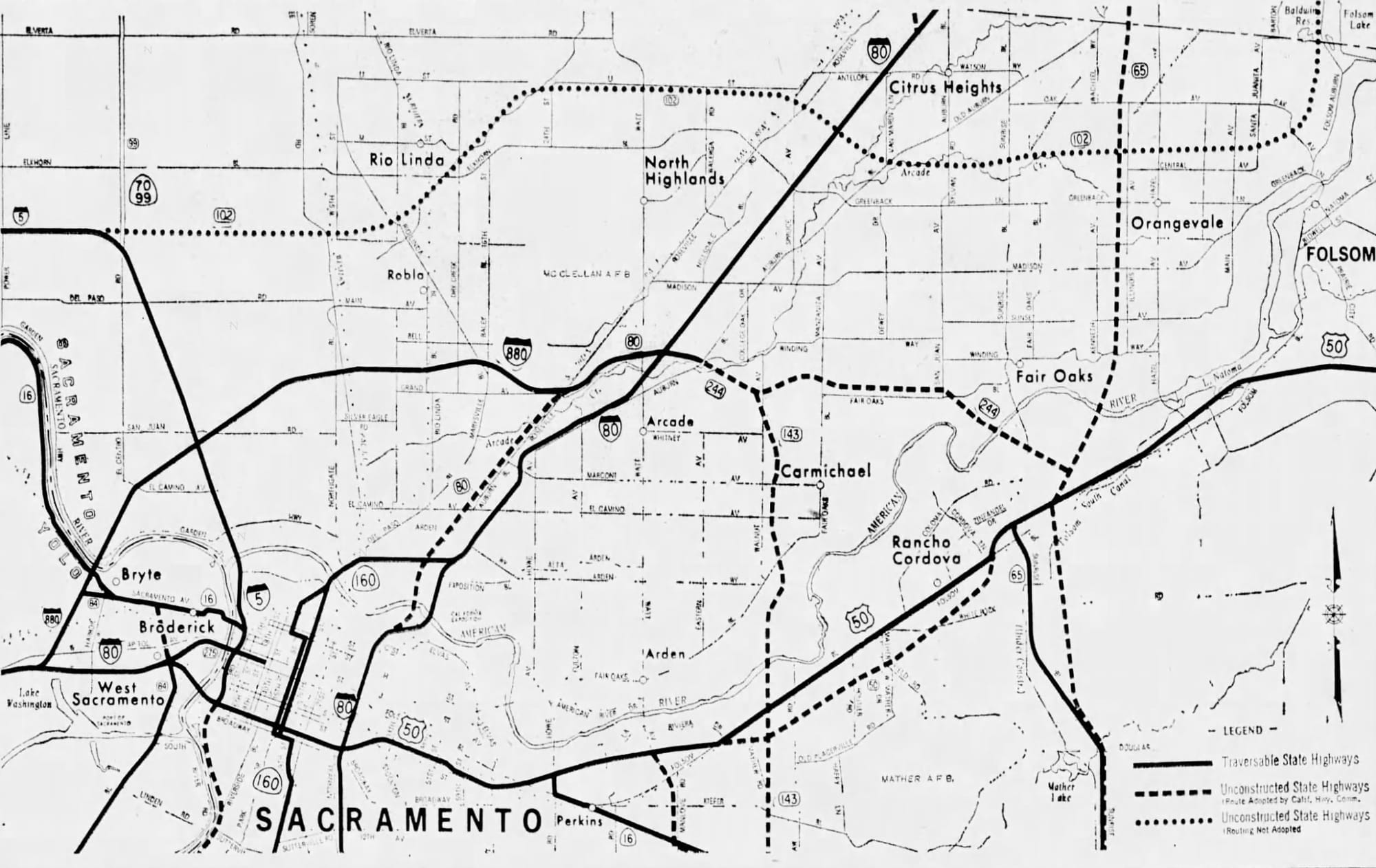
According to archival Sacramento Bee reports from the late 1950s through the 1980s, state and local agencies actively studied, mapped, and acquired rights-of-way for several of these corridors. Some early construction began—such as segments of Routes 244 and 143—but mounting public opposition, budget shortfalls, environmental concerns, and shifting political winds ultimately stalled progress.
The energy crisis of the 1970s and the anti-growth sentiment of the 1980s led regional policymakers to move away from freeway expansion. Even as the city's footprint continued to sprawl, the highway framework meant to support it never materialized.
Suburban growth pushed east and south into areas left underserved by freeways. Surface streets like Sunrise, Hazel, and Florin—never designed to handle regional traffic volumes—became de facto arteries, straining under increasing demand.
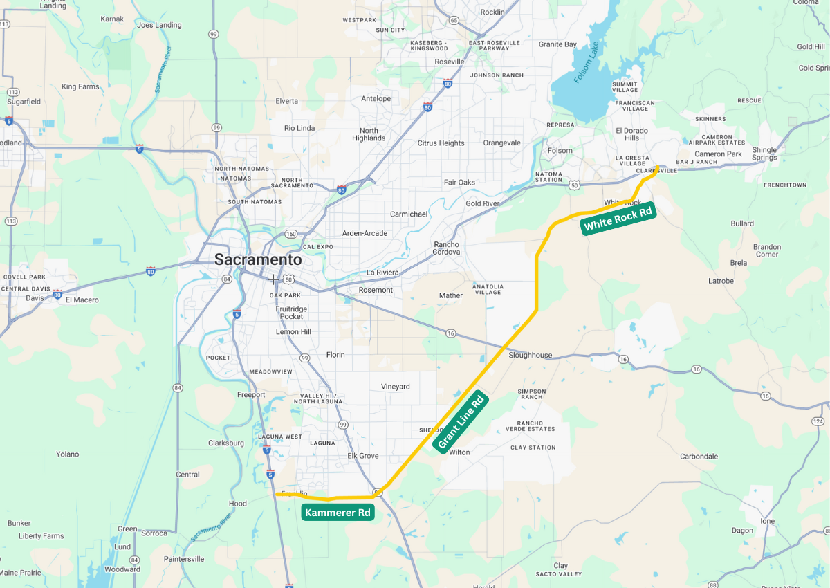
Fast forward to the 21st century, and a piece of the original beltway concept is finally materializing. The Capital SouthEast Connector is a planned 34-mile expressway linking Interstate 5 near Elk Grove to Highway 50 in El Dorado Hills.
Led by the Connector Joint Powers Authority—a coalition of Sacramento County, El Dorado County, Elk Grove, Rancho Cordova, and Folsom—the project aims to bypass downtown congestion while connecting suburban communities, freight corridors, and future growth areas. Today, it is recognized as the southern leg of the beltway envisioned more than half a century ago.
The project gained early traction thanks to strong public support. In 2004, Sacramento County voters approved Measure A, a half-cent sales tax for transportation improvements. The Connector was the only road project named in the ballot language, signaling its prominence.
Despite this mandate, the project has received only a small share of the funding. Of the $2 billion raised by Measure A, less than 2 percent—approximately $43 million—has gone toward the Connector. Planners have relied on leveraging these limited funds to attract state and federal grants.
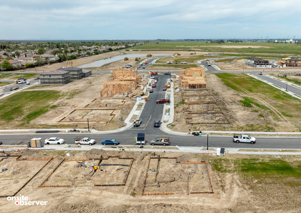
To date, approximately eleven miles of the expressway have been completed, including significant upgrades to Kammerer Road and White Rock Road, a new interchange at Highway 99, and rail grade separations. An additional nine miles are in final design, with openings anticipated by 2030.
Still, the project's future is uncertain. In 2016, the Sacramento Area Council of Governments (SACOG) removed a key segment from its regional transportation plan, jeopardizing eligibility for future funding. The decision reflected a broader shift in planning priorities toward infill development, public transit, and walkable urban spaces.
Yet supporters argue that the Connector aligns with these modern values. It incorporates multimodal features, preserves open space, and enhances safety for freight and commuter traffic alike. The project has garnered bipartisan backing from elected officials, tribal nations, business coalitions, and public safety agencies.
Its economic impact is also compelling, providing critical links between job centers, industrial zones, and growing residential areas in the region's southeastern corridor.
While Sacramento's original freeway plans may belong to a bygone era of mid-century optimism, the Capital SouthEast Connector offers a glimpse into what might have been—and what could still be achieved with coordinated leadership and regional investment.
In an era of resurging interest in infrastructure, the Connector is a rare attempt to fulfill a vision more than 60 years in the making. While it won't complete the entire beltway once planned around the city, it revives part of that legacy.